Geospatial Analysis Tools & Software: Support for Modern Construction Planning
Geospatial analysis refers to the process of collecting, processing, and interpreting data that has a geographic or spatial component. It focuses on understanding the relationship between physical locations, features, and patterns across a specific area. By combining mapping technologies, satellite imagery, aerial data, and ground-based surveying methods, geospatial analysis provides a detailed view of real-world environments. In modern construction planning, this approach has become an essential tool for improving accuracy, reducing uncertainty, and supporting informed decision-making throughout a project’s lifecycle.
Understanding Geospatial Analysis in Simple Terms
At its core, geospatial analysis answers questions about location and spatial relationships. It helps identify where features are located, how they interact, and how they change over time. For example, it can show how terrain elevation affects water flow, or how nearby infrastructure influences site accessibility. These insights are derived from spatial data collected through technologies such as GPS, drones, LiDAR systems, and satellite imaging.
The result is often a digital representation of the physical environment, such as maps, 3D models, or geographic information system (GIS) layers. These tools allow construction professionals to visualize complex site conditions in a way that traditional drawings cannot achieve.
The Role of Geospatial Analysis in Construction Planning
Geospatial analysis plays a significant role in the early stages of construction planning. One of its primary uses is site evaluation and selection. Before development begins, planners assess environmental and geographic factors such as slope, soil stability, flood risk, and proximity to infrastructure. This helps determine whether a location is suitable for construction and what potential challenges may arise.
By analyzing spatial data early, project teams can reduce the risk of unexpected issues during construction. This leads to better planning decisions and more efficient allocation of resources.
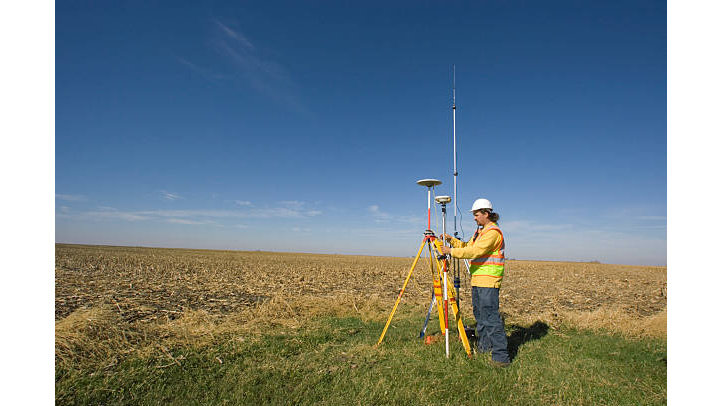
Improving Surveying and Site Mapping
Accurate site data is critical in construction, and geospatial analysis greatly enhances surveying processes. Modern techniques such as drone imaging and LiDAR scanning allow for the rapid collection of high-resolution spatial data. This information is then used to create detailed topographic maps and digital elevation models.
Industry experts like the team Lowry Surveys note that these models provide a precise understanding of the site’s physical characteristics, including elevation changes, surface conditions, and existing structures. As a result, engineers and planners can design projects that align more accurately with real-world conditions.
Supporting Design and Collaboration
During the design phase, geospatial analysis helps integrate architectural and engineering plans with actual site data. By overlaying design models onto geographic information, professionals can identify potential conflicts before construction begins. This reduces errors, minimizes redesigns, and improves coordination between different project teams.
It also enhances collaboration by providing a shared, data-driven view of the project site. Architects, engineers, and contractors can all work from the same spatial information, improving communication and decision-making.
Enhancing Construction Management
Geospatial analysis continues to play an important role during the construction phase. Updated spatial data can be used to monitor progress, track earthworks, and verify that construction aligns with design specifications. For example, comparing planned versus actual terrain changes allows project managers to identify deviations early.
This real-time or near-real-time insight helps improve efficiency, control costs, and reduce delays. It also supports better resource management by providing accurate measurements of materials and site conditions.
Improving Safety and Risk Assessment
Construction sites often involve complex environmental and structural risks. Geospatial analysis helps identify and manage these risks by evaluating factors such as flood zones, unstable terrain, and proximity to hazards. This allows project teams to implement safety measures before and during construction.
By understanding spatial risks in advance, companies can reduce accidents and improve overall site safety.
Conclusion
Geospatial analysis has become a key component of modern construction planning. By transforming spatial data into actionable insights, it improves site evaluation, design accuracy, project management, and safety. As technology continues to advance, its role in construction is expected to grow even further, supporting more efficient and data-driven development practices.
Lowry Surveys Inc
City: Madera
Address: 10878 California 41
Website: https://www.lowrysurveysinc.com
Phone: +1 559 645 4849
Email: sales@lowrysurveyinc.com


Comments
Post a Comment